


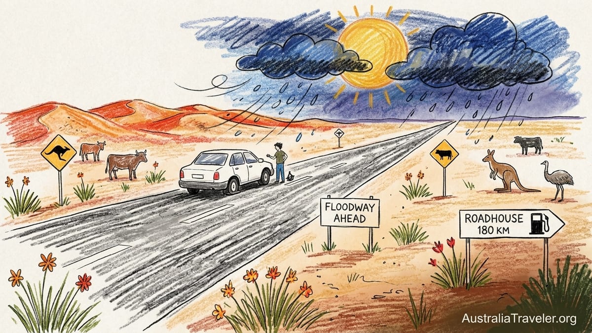
Halfway between roadhouses on the Stuart Highway, with the fuel gauge dropping faster than it should and storm clouds boiling on the horizon, I realised how naive I had been. The road ahead was ruler straight, shimmering in 40-degree heat, and completely empty. No houses, no side roads, no bars on my phone. I had set out believing that a sealed highway through the Australian interior would be “easy,” the outback equivalent of a long European motorway day. Now I was calculating distance to the next fuel stop, watching a tyre pressure warning light blink on, and wondering how long the water in the back would last if the worst happened.
How a “Simple” Highway Day Nearly Went Very Wrong
I had planned that leg as a routine drive on the Stuart Highway, the long ribbon of asphalt that runs roughly 2,720 kilometres from Port Augusta to Darwin. I had read that compared with the real bush tracks, it was “about as safe as it gets” for solo outback driving. That line stuck in my head. I took it to mean forgiving. What I forgot was that safe in outback terms is still a world away from the safety net of most road trips.
My mistake began with casual planning. I knew there were roadhouses and rest areas, and I skimmed a guide that mentioned long stretches between services. Instead of plotting exact distances and phoning ahead, I told myself I would “just top up when I saw fuel.” Leaving a roadhouse shortly after dawn, I decided to skip refuelling because prices were higher than the previous stop. It was a decision I would not make again. Several hours later, into a strong headwind with the air conditioning working hard, I discovered how quickly range estimates become fiction in the outback.
By late morning, the sky had darkened in that bruised, purple way that means serious weather in the Northern Territory. Roadside signs warned of floodways and past closures, but in my mind those were problems for the wet season, not late winter. Then the first fat raindrops hit the windscreen and the tyre pressure warning light came on. I pulled into a bare-bones rest area, no facilities, and found a slow leak from a stone bruise on the rear tyre. I had a space-saver spare, a small compressor, and a basic jack. What I did not have was a second spare, a proper plug kit or any guarantee that the next roadhouse would even be open for fuel if I limped that far.
In that moment the long, straight highway felt less like a road trip and more like a narrow corridor of risk. I had assumed that a sealed, relatively busy route could be treated like any other long drive. Instead, I was staring at a single compromised tyre, dwindling fuel and a rainstorm capable of closing side tracks and making detours impossible. Nothing truly catastrophic happened that day. I nursed the tyre, slowed my speed, reached the next roadhouse on fumes and queued behind road trains at the bowser. But the experience exposed exactly how thin my preparation had been. It also redefined my idea of what “remote” means in Australia.
Alice Springs and Uluṟu Are Not the Same as the Kimberley
In the weeks after that scare I started looking more closely at maps, safety advisories and trip reports. I realised that I had unconsciously lumped all “outback driving” into a single mental category. In reality, there is a big difference between sealed tourist arteries around Alice Springs and Uluṟu, and genuinely remote routes through the Kimberley, Cape York, the Northern Territory bush or the inland of Western Australia.
Alice Springs sits on the Stuart Highway, with Uluṟu reached via the sealed Lasseter Highway. You are still a long way from major cities, but you have a sealed surface, regular roadhouses, official rest stops and relatively predictable traffic. Distances are long, yet many travellers manage the run from Coober Pedy to Alice Springs or Alice to Tennant Creek with a conventional two-wheel-drive car, provided they respect fatigue, wildlife and fuel planning.
Compare that with the Gibb River Road in the Kimberley, a largely unsealed route that can be closed altogether during the wet season when river crossings become impassable. Local authorities openly caution that conditions change quickly after heavy rain, and that sections may be restricted to high-clearance four-wheel drives. On the Outback Way, sometimes promoted as Australia’s “longest shortcut,” roadhouses such as Tjukayirla, Warburton and Warakurna can be roughly 300 kilometres apart. Between them lie long sections of gravel and dirt where a breakdown is not an inconvenience but a potential emergency.
Cape York, the remote tracks of Arnhem Land, the Tanami and Plenty Highways, and Western Australia’s desert interior raise the stakes further. Here you may be hundreds of kilometres from a mechanic, with limited or no mobile coverage, seasonal flood closures and very little passing traffic outside peak months. Calling these journeys “road trips” barely captures the reality; they are remote expeditions by vehicle. Treating them as an extension of a sealed highway holiday is how good stories turn into coronial reports.
What I Ignored About Distance, Services and Silence
The most dangerous thing about long, straight roads is how easy they look on a map. A simple line between roadhouses hides the slow grind of distance, the monotony that breeds fatigue, and the fact that you cannot assume every service will be operating the day you arrive. After my near-miss, I began looking up actual spacing between roadhouses on major routes. It is common to find gaps of 180 to 300 kilometres on highways through the NT and WA interior, and that is before you venture onto more isolated tracks advertised to four-wheel-drive enthusiasts.
In theory, a modern vehicle with a range of 600 to 800 kilometres makes that manageable. In practice, a headwind, extra weight, soft sand detours or simply misreading the last quarter of a tank can erode your safety margin alarmingly fast. Operators and locals quietly advise a rule of thumb that seems absurd until you are there: treat every fuel stop as if it might be the last for quite a while. Power failures, staff shortages, delivery delays and weather can all temporarily close a roadhouse or leave only limited fuel available. When the next confirmed bowser is several hours away, “we are out of unleaded until tomorrow” becomes a serious problem.
Silence is another thing I underestimated. In cities, running out of fuel or suffering a mechanical fault is an inconvenience resolved by a quick call and a short wait. Outback coverage maps show a very different picture. Outside regional centres such as Darwin, Alice Springs, Broome or Mount Isa, large areas of the Northern Territory and Western Australia simply have no mobile signal at all. I remember watching my phone drop from a solitary bar of 3G to “no service” for hours at a time, while signs on the verge reminded drivers that the next emergency call point or roadhouse might be more than 150 kilometres away.
This is why local governments and motoring clubs still stress old-fashioned basics: tell someone your route, your planned overnight stops and what time you expect to arrive. Check in by message or satellite device whenever you can. If you are overdue, someone at home should have enough information to raise an alarm with police or local authorities. It feels melodramatic when you are standing in an air-conditioned hire car depot. It does not feel melodramatic when you are 200 kilometres from the nearest town, watching the sun drop and the kangaroos emerge.
The Road Is Straight, the Conditions Are Not
My second flawed assumption was that a smooth-looking bitumen strip meant predictable driving. In reality, sealed and unsealed outback roads can change character every few kilometres. Heat warps surfaces. Heavy vehicles carve wheel ruts. Sudden downpours flood dips and creek crossings. Graders leave loose gravel that behaves like marbles under your tyres. Even on the Stuart Highway, you can move from good asphalt to patched repairs, narrow shoulders and windblown debris with little warning.
Unsealed roads multiply these variables. Corrugations can shake vehicles to pieces, from shock absorbers to roof racks. Fine “bulldust” hides deep holes that can swallow a wheel. After rain, clay sections become slick and impassable, trapping even experienced drivers. Local councils and road authorities issue frequent updates for routes like the Gibb River Road, Tanami Road and Cape York tracks, warning of depth at creek crossings and restrictions such as “high clearance four-wheel drives only.” Those notices exist because each wet season literally redraws the road.
Then there is the heat. Inland Australia routinely sees daytime temperatures above 40 degrees in the hotter months, with the Kimberley and Top End combining high heat with punishing humidity. That affects tyre pressures, engine cooling and, most importantly, people. Sitting motionless behind a wheel for hours in a hot cabin is a recipe for dehydration and fatigue. Emergency services remain blunt about this: walking away from a broken-down car in these conditions can be fatal. The vehicle offers shade and a larger target for aerial search. Adequate water is not a comfort item but life support.
Wildlife and livestock add a dynamic hazard, especially around dawn and dusk. Kangaroos, wallabies, cattle, wild horses, camels and even emus may graze on the verge and bolt across the road without warning. Locals repeat a mantra that at first sounds overcautious: do not drive at night unless you absolutely must. Oncoming headlights hide animals until they are almost under your bumper, and a collision with a cow or a large kangaroo at 100 km/h can destroy a vehicle. On some highways you will encounter road trains hauling triple trailers; sharing a narrow, uneven road surface with more than fifty metres of moving steel is no trivial challenge.
Why a Hired 4WD and “Full Insurance” Are Not Enough
In the city, it is tempting to believe that problems can be outsourced to a product. Hire a four-wheel drive, tick the box for “full cover,” and surely the company would not let you drive anywhere truly unsuitable. Remote Australia does not work that way. Read the fine print of major rental agreements and you will find long lists of excluded roads, restrictions on water crossings and clauses that void coverage if you ignore weather or closure warnings. Many contracts explicitly exclude iconic names such as the Gibb River Road, Oodnadatta Track, Canning Stock Route, Telegraph Track to Cape York or unapproved river crossings.
Even on allowed routes, you remain responsible for basic competence. Four-wheel drive does not grant immunity from sand, mud or flooded causeways. I have sat at outback roadhouses listening to mechanics describe rescuing tourists who engaged low-range for the first time while already bogged to the chassis. Recovery trucks, where available, can cost thousands of dollars for a single call out, and there is no guarantee the bill falls on the rental company rather than the driver. Some travellers discover after an incident that the generous-sounding “zero excess” cover applied only on sealed roads and under standard conditions.
Then there is equipment. A proper outback-capable four-wheel drive is more than high clearance and chunky tyres. It needs appropriate load-rated tyres, a second spare wheel, a jack that can cope with soft ground, rated recovery points, and secure mounting for extra fuel and water. Many mainstream rentals supply only a single spare and a compact jack, aimed at highway punctures rather than remote track failures. Unless you ask detailed questions and inspect the gear, you may drive away with an impressive vehicle that is only half prepared for where you intend to go.
Insurance also does not cover poor judgment. Driving into a clearly signed flooded crossing, pushing on along a closed road, or attempting a remote detour without proper maps can void your protection and prompt uncomfortable conversations later with both police and insurers. One Kimberley information brochure phrases it simply: if you get into trouble on a closed road, do not expect sympathy.
Communication, Water, Fuel and the Gear I Now Refuse to Travel Without
After that day on the highway I rewrote my own minimum kit list. The first addition was a form of satellite communication. In regions where even major highways drop to zero mobile coverage for hours, a satellite messenger or phone is not a luxury. Devices that allow simple check-in messages and SOS alerts give you a direct line to emergency services if things go badly wrong. Hiring or buying one adds a few hundred dollars to a trip, but compared with the cost of recovery or the consequences of being unable to call for help, it feels like cheap insurance.
Offline navigation was next. Relying purely on live phone maps is a fragile strategy in the outback. I now download detailed offline maps to my phone and tablet before leaving coverage, carry a dedicated GPS unit in the glovebox and keep a paper road atlas in the door pocket. On remote tracks, some communities and Aboriginal-owned lands also require permits or have restricted access. Printed or PDF notes from visitor centres and land councils live with my maps, so I am not trying to interpret rules while parked on a dusty verge with no signal.
Water and fuel planning became more disciplined. The old touring standard of at least several litres of water per person per day is a starting point, not an aspiration. In the desert interior I aim to carry enough drinking water for at least two extra days on top of my planned journey, stored in multiple containers rather than one big jerry that can crack or leak. For fuel, I calculate consumption based on worst-case figures from previous drives, then add a generous buffer. Extra jerry cans secured properly against movement come along on any route with gaps of more than 200 kilometres between reliable fuel stops.
Tyre equipment rounds out the essentials. A second full-size spare tyre, a robust jack plate for soft ground, a basic plug repair kit and a portable compressor now travel with me whenever I leave the well-serviced belts of the east coast. They do not turn me into a bush mechanic, but they do mean that a simple puncture need not escalate into an emergency. Roadside advice in Queensland and Northern Territory safety guides makes it clear: a surprising proportion of roadside rescues in remote areas still come down to basic tyre failures on vehicles that set out underprepared.
Crocodiles, Desert Heat and Respecting the Country You Cross
Remote Australia is not uniform. The hazards around Darwin, Kakadu or Cape York differ sharply from those on the Nullarbor or the Tanami. Nowhere is that more obvious than in the presence or absence of large crocodiles. In tropical northern rivers, billabongs and coastal waters, saltwater crocodiles are a very real risk. This matters for overland travellers because many appealing campsites, swimming holes and water crossings lie in or near their habitat. Ignoring local advice or posted warnings to cool off in a remote creek is not an act of bravado. It is a genuine life-or-death mistake.
Official guidance in the Top End is unambiguous: assume every waterway in known crocodile country may contain crocodiles unless it is clearly signed and managed as a safe swimming area. Do not camp right on the water’s edge, clean fish or discard scraps near the bank, or wade through murky shallows just because you saw tyre tracks there. Rangers and police regularly report relocating or destroying large crocodiles in areas that some travellers still assume are safe because they “looked quiet.” A four-wheel drive bonnet provides no protection if you choose the wrong spot to enter the water.
Desert driving replaces crocodiles with exposure. On the Tanami, Plenty, Great Central Road or inland WA tracks, open country, lack of shade and extreme diurnal temperatures are the dominant threats. Vehicles that leave the road and roll, even at relatively low speeds, can leave occupants far from help with injuries and little shelter. Here, planning rest stops in line with official rest area maps, avoiding the hottest hours of the day and never leaving your vehicle after a breakdown are recurring themes in government travel advice.
Many of the most compelling routes also cross or border Aboriginal-owned land. In parts of Western Australia, the Northern Territory and Queensland, entry to communities and certain tracks requires permits issued by land councils or local authorities. These are not optional extras. They exist to protect communities, cultural sites and the land itself. Applying in advance, respecting closures and obeying alcohol and camping regulations should be treated as core trip planning, just as important as plotting fuel stops. Being turned around at a community boundary because you do not have the right permit is inconvenient. Arriving uninvited or ignoring local rules is simply disrespectful.
Self-Drive Freedom vs the Real Cost of Guided Support
Once you add up all the preparation required for responsible remote driving, guided tours start to look less like a luxury and more like an alternative form of insurance. Small-group or private expeditions into the Kimberley, Arnhem Land or Cape York are undeniably expensive on paper. Multi-day four-wheel drive safaris that include professional guides, vehicles, permits, accommodation and many meals can run into thousands of dollars per person. At first glance, that dwarfs the daily rate of a rental vehicle and a swag.
However, the true cost of a self-drive expedition into serious remote country is not just the hire fee. There is the premium for a suitable four-wheel drive, often higher in peak dry-season months. There are fuel bills across long distances, which in isolated roadhouses are significantly higher than metropolitan prices. There is the outlay for extra equipment, from satellite communicators and recovery gear to quality tyres and a second spare, whether bought or rented. Permits, campground fees, national park passes and occasional motel nights in staging towns add more. Once you factor in the possibility of repair bills or recovery costs, the gap between self-drive and a well-run guided trip narrows.
Guided operators also bring intangible assets. They know current road and track conditions, maintain relationships with station owners and communities, understand local weather patterns and can read a river crossing in ways that first-time visitors simply cannot. If conditions turn marginal, they have the authority and experience to turn back before a situation becomes dangerous. As a solo or small-party driver, pride and sunk costs can push you to keep going when you should stop, especially after weeks of planning and travel to reach a bucket-list track.
For moderately remote adventures such as the sealed highways around Alice Springs, Uluṟu and the easier sections of the Stuart or Barkly Highways, I still prefer to self-drive. The risks can be managed with sensible preparation, conservative driving hours and respect for local advice. But for genuinely remote expeditions deep into the Kimberley, Cape York’s harder tracks, the western deserts or extended off-grid travel in the wet-dry tropics, my appetite for independent risk has fallen sharply. If I go, it will be with a professional guide in convoy, or not at all.
The Takeaway
That morning on the Stuart Highway did not end in disaster. I reached fuel, changed the damaged tyre in the dusty yard of a roadhouse and drove away with nothing worse than embarrassment and a lighter wallet. Yet it fundamentally changed how I view remote Australian driving. The lesson was not that the outback is off limits, but that long, straight roads are deceptive. They encourage a kind of complacency that simply does not match the environment they cross.
Today, my personal predeparture checklist for any outback trip includes a detailed fuel plan showing distances and contingencies; confirmation of roadhouse opening hours as close to departure as possible; a satellite communicator or phone; downloaded offline maps and a paper atlas; at least one extra day of water and food beyond my planned itinerary; two full-size spare tyres and a repair kit; a clear, written route and schedule left with someone at home; and current information on road conditions, closures, permits and any relevant crocodile or fire warnings.
For a first-timer keen to taste the outback, I would recommend starting with relatively accessible sealed routes: Darwin to Katherine and back during the dry season, the Stuart Highway between Port Augusta, Coober Pedy and Alice Springs, or the loop from Alice to Uluṟu and Kings Canyon via sealed roads. These journeys still demand respect, but services are more frequent, and help is easier to reach. They offer big skies, red earth and star-filled nights without asking you to stake your safety on advanced four-wheel drive skills and expedition-level logistics.
When it comes to the more remote tracks that fire the imagination, my own verdict is now clear. The Gibb River Road, Cape York’s rougher lines, extended detours on the Tanami or Plenty, and long forays into Western Australia’s desert interior are adventures I would only attempt with professional support or in convoy with highly experienced companions. The cost, in money and humility, is high. The cost of getting it wrong, alone, far from help, is higher still.
FAQ
Q1. Do I really need a four-wheel drive to experience the Australian outback?
For sealed routes such as the Stuart Highway or the road to Uluṟu, a well-maintained two-wheel-drive vehicle can be sufficient in good weather, provided you plan fuel and avoid night driving. For unsealed tracks in the Kimberley, Cape York or desert interiors, a properly equipped four-wheel drive is strongly recommended and often required by rental contracts and local authorities.
Q2. How much water should I carry on a remote outback drive?
Guidance from emergency services often suggests several litres of drinking water per person per day, with extra in reserve. In practice, many experienced travellers aim to carry enough for at least one or two additional days beyond their planned journey, stored in multiple containers so a single leak does not compromise all supplies.
Q3. Is mobile reception really that bad outside major towns?
Yes. Large parts of the Northern Territory, Western Australia and inland Queensland have little or no mobile coverage away from main centres and some highways. You may travel several hours without signal. That is why satellite devices, offline maps and leaving a detailed itinerary with someone at home are so heavily emphasised in local safety advice.
Q4. Can rental car insurance cover me on roads like the Gibb River Road or Cape York tracks?
Many mainstream rental agreements either exclude these roads entirely or apply strict conditions, especially around water crossings and unsealed surfaces. Even “full cover” products often apply only to sealed roads. It is essential to read the contract carefully, ask the rental company to clarify any excluded routes and obtain written approval if you plan to drive specific tracks.
Q5. How dangerous is it to drive at night in the outback?
Night driving significantly increases the risk of collisions with wildlife and livestock, and makes it harder to judge road edges, potholes and unsealed sections. Locals and motoring clubs consistently recommend avoiding driving between dusk and dawn whenever possible, especially on roads with heavy wildlife activity or where large road trains operate.
Q6. Do I need permits to drive through Aboriginal-owned land?
In several regions of Western Australia, the Northern Territory and Queensland, access to Aboriginal land, communities or specific tracks requires permits from land councils or other authorities. These permits may take time to process and often include conditions on camping, photography and alcohol. Checking permit requirements well before departure is an essential part of planning.
Q7. How should I prepare for crocodile risk when driving in northern Australia?
In tropical regions such as the Top End, you should assume any river, creek or coastal water may contain crocodiles unless clearly signed as safe. Avoid swimming in unmarked spots, do not clean fish or leave scraps near the water’s edge, and choose campsites back from the bank. Obey all local warnings from rangers and visitor centres, and be particularly cautious around boat ramps and causeways.
Q8. What is the safest first-time outback route for a self-drive trip?
Good introductory options include the Stuart Highway between Port Augusta, Coober Pedy and Alice Springs, the sealed road to Uluṟu and Kings Canyon, or a dry-season circuit between Darwin, Litchfield National Park and Katherine. These routes offer long distances and classic scenery, but with more frequent services and easier access to help than remote tracks.
Q9. Are guided tours worth the higher upfront cost?
For genuinely remote regions such as the Kimberley, Cape York’s difficult tracks or desert crossings, guided small-group or private tours can be a safer choice. When you factor in rental, fuel, equipment, permits, park fees and potential recovery or repair costs, the price gap between self-drive and a reputable guided operator is often smaller than it first appears, especially for solo travellers.
Q10. What is the single most important safety step before an outback road trip?
If forced to choose one, it would be to create and share a detailed written plan: your route, overnight stops, expected arrival times and emergency contacts. Combined with realistic driving hours, adequate water and a way to call for help from areas without mobile coverage, that plan turns an outback drive from a risky gamble into a managed adventure.